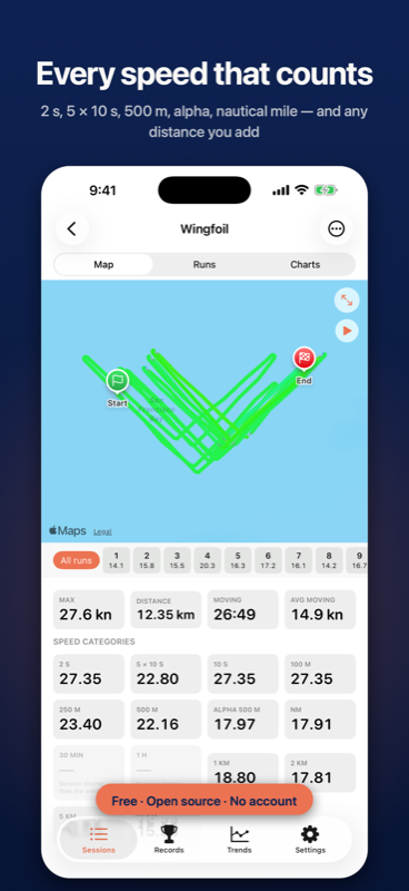
speed, measured properly
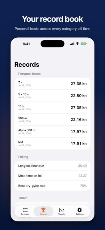
Every category the speedsurfing community actually uses: 2-second peak, best 10 seconds, 5×10s average, 100 m through 10 km, nautical mile, alpha 500, 30-minute and 1-hour averages — plus any custom distance you add, applied retroactively to sessions you already recorded.
Speeds come from the receiver's Doppler measurement and are computed on the continuous track, not snapped to the nearest GPS fix — because one second of slop is ten metres at twenty knots.
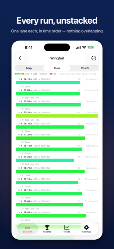
runs, unstacked
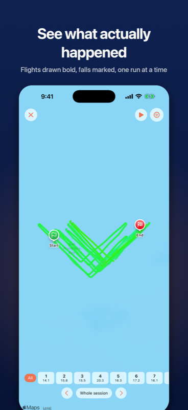
An hour of winging in a bay is forty passes through the same water — drawn as one line, it's unreadable. The Runs view drops the map entirely: one lane per run, stacked in time, so nothing overlaps. Your session reads top to bottom like a score.
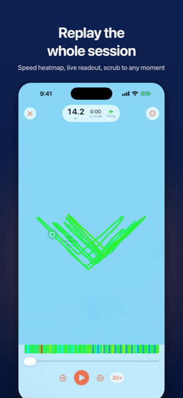
Session replay
watch it back
Replay the whole session with a playhead, speed heatmap and live readout — and see exactly where every flight, gybe and fall happened.
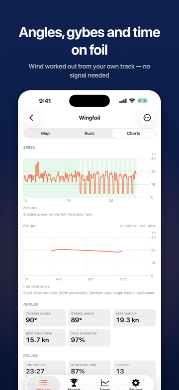
angles, gybes and time on foil
Wind direction worked out from your own track — no weather service, no internet.
Polar curve, VMG upwind and downwind, tacking and gybing angles.
Gybes and tacks detected and scored: entry speed, minimum speed, recovery time, and whether you stayed on the foil.
Time on foil, number of flights, longest flight, takeoff speed.
Port versus starboard comparison — see the side you've been quietly avoiding.
For downwinders: glides detected from the pump-and-glide rhythm, longest glide, link rate and swell period.
your record book
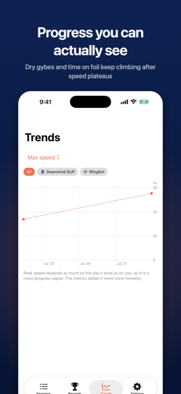
record on your watch or your phone
Start a session in one tap. The Apple Watch app runs standalone — it doesn't need your phone nearby, or even installed.
Built for the water
Water Lock engages automatically, and the session keeps recording with the screen off and your wrist down. Seven live screens: speed, splits, totals, wind angles, foil time, controls, and a racing start countdown.
Crash-safe recording
Your track is written to disk continuously, so a flat battery or a crash costs you seconds, not your session.
Honest numbers
Every session is graded for GPS quality. Detected gybes and jumps carry a confidence score, and the raw samples are always kept so you can check anything.
Apple TV
check the wind from the couch
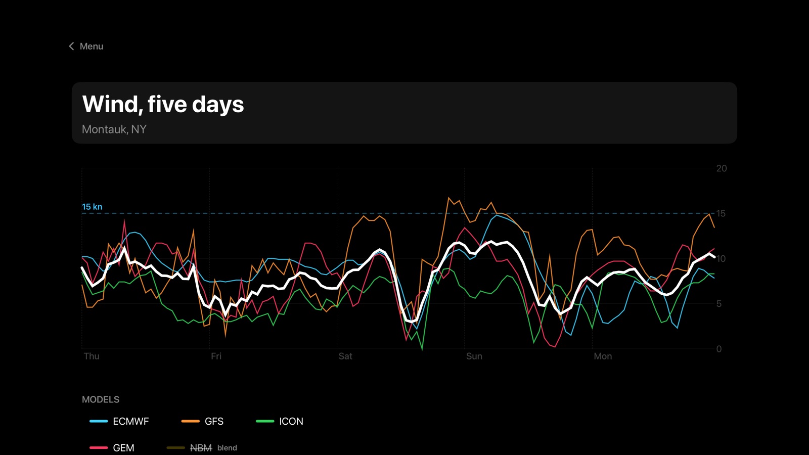
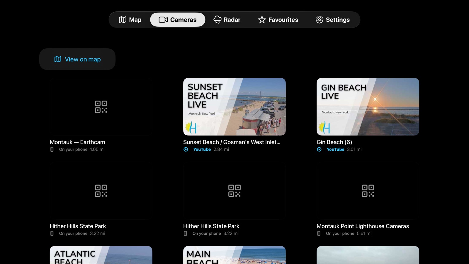
The whole conditions picture on the big screen — wind, radar, tide and the webcams for the coast you're on and the spots you've starred. The Apple TV app records nothing; it's for deciding whether to go.
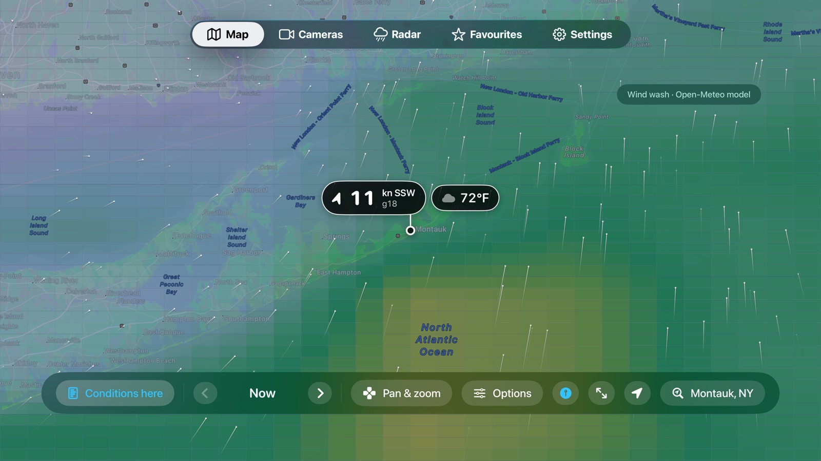
A wind map you drive with the remote
Forecast wind drawn over your stretch of coast. The D-pad pans, Select zooms, and the crosshair gives the full report — wind, gusts, weather, waves and tide — for wherever it rests.
See when the models agree
The five-day outlook lays ECMWF, GFS, ICON and GEM over each other, so a forecast every model believes looks different from one only a single model does.
Cameras, radar and your spots
Webcams that tvOS can play, play; the rest show a QR code that opens them on your phone. Rain radar and a board of your starred spots round it out.
Privacy
your data is yours
Import anything
GPX, TCX, FIT and CSV — bring your history from Garmin, Coros, Suunto and most other apps.
Export everything
GPX, TCX, CSV, GeoJSON, or a complete lossless archive. Sharing trims the start and end of your track by default — those are usually your car or your home.
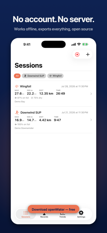
No account, no server
No sign-up, no tracking, no analytics in the app. Nothing leaves your device unless you send it. The complete source — including every analysis algorithm — is public on GitHub.
find your next spot
The OpenWater Foil Spot Guide maps 960 foiling launches across 116 countries — with conditions, launch access, wind meters, webcams, tides and local guides for every spot, from the Gorge to the Med.
Browse the Spot Guide